With our comprehensive guide, you'll navigate with confidence, unlocking the true essence of New Caledonia's stunning natural beauty. Discover hidden coves, pristine beaches, vibrant marine life, and fascinating cultures, all while enjoying the tranquility of this tropical paradise. Get the Rocket Cruising Guide to unlock the endless possibilities of adventure in New Caledonia.
Crafting the ideal cruise plan for your New Caledonia adventures can be difficult - and you need be able to change it quickly according to the weather. You're faced with determining the best anchorages, dive spots, and onshore treasures without knowing what each location truly offers. Relying solely on nautical charts, internet snippets, and word of mouth is time-consuming and doesn't guarantee your choices will be best for you, your crewmates or your yacht.
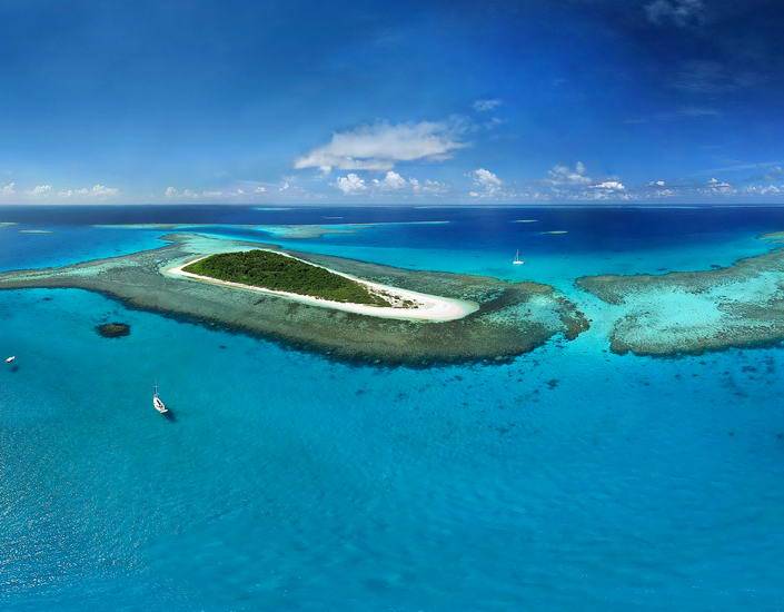
The Rocket Cruising Guide, with its professional high-resolution images, detailed surveys and precise GPS positions, unveils the unique offerings of 220 anchorages covering all of New Caledonia's lagoons and islands. You'll know exactly what each anchorage is like before you go so you can confidently select the routes and anchorages for the maximum pleasure for you and your shipmates.


The Rocket Guides work on Windows tablets but to use them on an Ipad or Android tablet you will need to connect the tablet to your notebook by WiFi using a special app. As long as your notebook is operating nearby, you can see and use the guide on the tablet.
You'll get the best use of the Rocket Guide - and have the best time cruising in New Caledonia - if you spend some time exploring on the guide and discovering how it works before you set sail for New Caledonia. Here's a brief example of how to develop a cruise plan on the Rocket Guide:
Electronic charts are digitized versions of existing nautical charts with much of the depth data dating back many years. They are normally good wherever ships go but not so good in small bays where yachts want to anchor - and very poor in remote areas of Vanuatu and even parts of New Caledonia.
Neither the charts or Google Earth will tell you if your anchor is going to dig in properly or precisely where to anchor without damaging the coral. Google Earth is great except where sun reflection or clouds or cloudy water prevents you from approximating the depths (assuming you are a trained expert at aerial photo interpretation). Even in well charted areas with good imaging you won't discover the best dive spots, trails to walk, or where to buy parts, how to get your gas bottle filled, how to connect to the local internet or what the internet reception is in an anchorage or who can fix your autopilot or freezer or do any other repairs you need.
None of the resources you mentioned will tell you how to avoid potentially toxic foods or polluted water or how not to be harmed by dangerous marine animals.
The Rocket Guides help when you really need the information to avoid or solve a serious problem.
We sailed all the routes on our guide - often many times. If you like to figure out your own routes all you need to do is load one of our gpx routes into your plotter and have a look at it. If you think a waypoint should be moved - go ahead and move it. It will still save you a lot of time.
The GPS Route numbers are shown on the photocharts - from the South Pacific to an individual ancorage when you click on the anchor button (sailing directions) and listed with details when you point to the little sailboat button (navigation directions). The routes are saved as gpx files in the program's folder.
All you need to do to find out how to use the the gpx routes is google "how do I import gpx route files into a (Your GPS or Plotter Make and Model)."
You will also find detailed instructions for using the routes on the Rocket Guide. Open the guide and from the all New Caledonia view click on the anchor button (sailing directions) and then click on "using routes".
Our guides don't make choices for you or tell you where to go, they enable you to make your own cruise plan and decisions based on accurate, up to date data and images of the highest quality.
Without the Rocket Guide you could easily miss some of the most amazing dive spots, waterfalls, and treks. Or you might have to spend a lot of time to discover the best places to shop, rent a car, or who to call when you need a repair on your yacht (we only recommend repair facilities we know are good - and believe me, not all of them are good).
Freddy and I had decades of experience entering difficult harbours and passes and often had to climb the mast to get high enough for a good view of what was dead ahead. Even then we could never be sure of the depths or dangers.
In 1986 I was helping train mapping personnel from the Lands and Survey departments of the Pacific Islands on how to do Ground Truth Surveys so they could create paper charts from high resolution aerial photography and develop land use plans for sustainable development. Representatives of the brand new French SPOT satellite program and the US NASA Landsat program attended the workshop and when looking at these early satellite images I thought how great it would be if I could create a cruising guide based on the idea of hovering over the islands in a space ship with super sensors that could overlay the images with depths, dangers, navigational markers, safe routes, points of interest and the ability to zoom in and see surface level images and even see underwater. SciFi stuff at the time.
In 1999, using my contacts with SPOT, NASA and the local Lands and Survey libraries of high resolution aerial imagery I collected enough aerial and satellite imagery plus all the nautical charts for Vanuatu to try the Rocket idea. This was 8 years before Google Earth and the concept of digital geographic information systems was just getting started.
Freddy and I did all the software design and coding, took all the images (except the aerial and satellite images) and surveyed all the anchorages.
The first Vanuatu Rocket Cruisng Guide was published in 2000 and, at the request of the Vanuatu Tourism Department we created the Rocket Travel Guide to Vanuatu. In 2005, using the same concept, we developed the Rocket Cruising and Travel Guides to New Caledonia. Every year since the first publication we improved and perfected the guides and added new information and images to them, often publishing updated versions four or more times a year, to assure the information is up to date and to maximize the utility of the guides for sailors like yourself. This was a huge advantage over paper books that require reprinting and shipping at great cost. Click here for more about creating the Rocket Giuide

Frederique and I have been cruising the South Pacific for over 40 years aboard our 14.5m cutter Moira. I am a Ph.D. marine scientist and have been living aboard my own boats since 1958. Freddy's ancestors were sea people. We first came to New Caledonia in 1980 and have, over the years, pretty much cruised everywhere. We began making the Cruising Guide to New Caledonia in 2000 (eight years before Google Earth existed) and have constantly updated it with new information and photographs ever since.
We personally did detailed hydrographic surveys of anchorages and challenging reef passes where there are no reliable nautical charts. We have used every one of the 240 GPS routes and anchored in all 220 anchorages shown on the guide.
The message here is that the information on our guide is current, reliable, practical, and easy to find. Whatever you need to know about cruising in New Caledonia is on the guide. You don't have to go online for any of it. There is so much information on the guide you'll probably never see it all - but when you need a suggestion, an idea, or a really clear idea of what you'll find if you go to a likely looking anchorage - you get it right away.